Applications - Remote Sensing
The advances in remote sensing equipment and processing software in recent years has significantly broadened the range of possible applications that aerial surveying can provide. Aerial surveying provides an economical alternative to traditional ground based survey techniques. This allows imagery and data to be acquired for large areas in a minimal timeframe enabling faster application turnaround.
Digital Mapping Australia is continually looking at new applications for digital data acquisition. Our aim is to provide practical solutions to clients while maintaining a focus on developing alternative methods to create a market niche. To achieve this DIMAP focuses on acquisition using aircraft equipped with multiple sensor technologies and applications combining information from these different data sets.
Digital Imagery
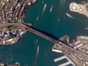
Large-format digital imagery provides council and goverment with high resolution urban and regional imagery for planning and infrastructure development. With a ground resolution typically ranging from 5 to 50cm, the high level of detail provides impressive imagery ideal for public display.
Carbon Footprint
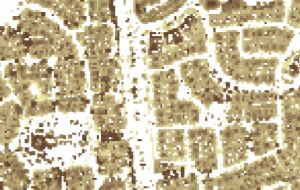
The digitised echo return provided by full waveform LiDAR scanners provide the means to determine Carbon Foot-printing and Vegetation Biomass calculations over large areas. The use of sophisticated analysis techniques permits the extraction of buildings, volume and floor area calculations in order to derive carbon footprint values. Similar analysis classifies vegetation into low, medium and high ground cover.
Further analysis of the full digitised waveform signatures aids vegetation classification,ie tree types, foliage coverage and structure. The Combination of this information with periodic surveying produces measurable comparative figures which assist future planning and development while balancing the need between urban development and the natural environment. In addition, proposed urban development and re-vegetation projects can be modelled and carbon footprint impacts predicted.
Power Line Classification
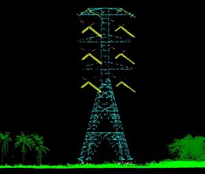
Interconnecting power networks involves vast amounts of power lines and infrastructure, which often traverse rugged and difficult to access areas. Using LiDAR (Light Detection and Ranging) corridor mapping scanners from an airborne platform provide a cost-effective solution to monitoring existing powerline routes as well as planning new routes.
The accurate digital elevation and terrain models, along with discrimination between ground, vegetation and infrastructure permit:
- A cost-effective survey solution
- Power line route planning
- Detection of clearance violations
- Vegetation encroachment to minimise potential flash-over and bushfire risks
- Tower location planning and catenary curves of linesí
- Calculate overhead heights for through-vehicle and high-vehicle traffic analysis
Urban Modeling
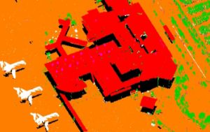
LiDAR-based point classification routines and contouring,combined with digital imagery,empower local goverment and council with the data required for urban modelling and development.
Forestry
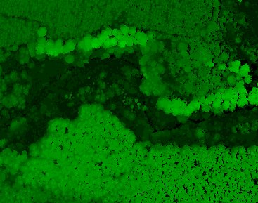
By extracting the digitised laser pulse return provided by the full waveform LiDAR, additional statistical and mathematical models can be applied and extrapolated.
Statistical analysis of the full waveform has enabled the development of biomass and fuel load models that can be acquired from the air covering large areas of forestry and bushland in a cost effective manner.
Combining this information with point cloud classification routines such as tree counts and contouring can enhance the understanding of vegetation characteristics.
Mineral Mapping Geology
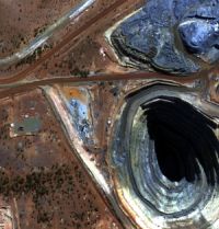
Hyperspectral scanning enables mineral identification using mineralogical indices for geological applications.
Aspect LiDAR
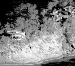
DIMAP has pioneered a different perspective on LiDAR data acquisition in order to solve a fundamental limitation of airborne laser scanners and imagery (they all have a birdís eye view of the earth as long as the bird is looking straight down). This limitation makes developing accurate and detailed mapping of vertical structures such as cliff faces, coastal ridges or any vertical side of a natural or man made structure impossible.
DIMAP has developed a specialised scanner mount for use in a helicopter, along with customised processing techniques. This enables the vertical faces of structures to be revealed from the air.
Thermal Imaging
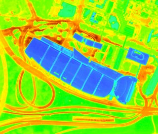
Thermal aerial photography can be used to;
- Analyse energy loss from buildings and ground features
- Monitor and compare heat losses for individual residential, commerical and industrial properties
- Develop and monitor energy conservation programmes
- Graph and display the largest energy losses over an area
- Explain heat island analysis which pin point areas of heat storage
- Aid council planning of vegetation for the reduction of heat islands
- Monitor water temperature differences, currents and flows
Hydrology
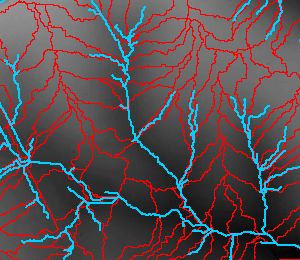
Extracted from the LiDAR data sets Hydrological modelling permits:
- Flood plain mapping
- The design/engineering of flood channels and pipelines
- Water quality management and understanding how land development will affect ecosystems
- Economical surveying of large urban and rural areas with a fast turnaround
- The detection of likely flood/flow congestion areas for drainage review
- The combination of dataset with existing stormwater pit and pipe models
