Equipment, Sensors & Scanners
At DIMAP we pride ourselves on having the latest and most advanced survey and mapping equipment available.
We are actively involved in research and development programs working with many of the world's leading sensor and equipment suppliers. We have drawn on many years of experience to integrate and streamline our acquisition, processing and production methods in order to provide our clients with the shortest possible turnaround on customised data acquisition solutions.
Multi Sensor, Single Flight Data Acquisition
Using our twin engine aircraft that is custom modified for multiple sensor configurations, enables the aquisition of several data sets in a single flight. Installed configurations include but are not limited to LiDAR, Hyperspectral Imagery and Thermal sensors. This combination is tailored upon acquisition requirements, therefore reducing aircraft mobilisation and flight costs.
The combination of different data sets allows advanced production methodologies and enhanced analysis such as the combination of hyperspectral vegetation detection with LiDAR tree counts, thermal footprint analysis with LiDAR extracted buildings, or hydrology water flow modelling enhanced with hyperspectral vegetation water indexing.
Large Format Digital Imagery
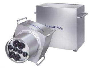
Our UltraCAM-D produced by Vexcel in Austria (recently acquired by Microsoft) is a large-format digital aerial camera system. The Vexcel Corp. is a worldwide leader in photogrammetry, imagery and remote sensing technologies with extensive experience in 2-D and 3-D imagery.
The UltraCAM-D delivers high resolution digital imagery that is radiometrically and geometrically superior to that of conventional film cameras while providing significant cost savings and faster turnaround time to deliver an end product.
The UltraCAM-D delivers panchromatic images with 11,500 x 7,500 pixels based on 9 individual CCDs giving over 86 mega-pixel resolution. Multi-spectral optical cones produce colour separates in red, green, blue and near infrared. Forward-motion compensation availability by means of time delay integration enables the use of long exposure times in dim light conditions to produce high-quality images.
Light Detection and Ranging - LiDAR
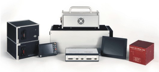
Our RIEGL built laser scanner complemented with the IGI Systems LiteMapper fully-integrated sensor package provides a state-of-the-art high resolution laser measurement system.
The LiteMapper system features full return waveform digitisation. Unlike the more common discrete echo detection laser scanners which return only single points in time, the RIEGL scanner captures the entire echo waveform in digitised format. This digitising provides access to target parameters for accurate and detailed mapping of vertical structures, improved reliability and accuracy of elevation, enhanced discrimination between vegetation and infrastructure along with superior range and resolution.
We are proud to offer our clients full waveform data packages enabling further post-flight processing and analysis.
This versatile laser scanner suits a wide range of high-precision engineering applications such as:
- Topography & Mining
- Corridor Mapping for Infrastructure & Geography
- High Accuracy City Modelling
- Lakeside, River & Coastal Mapping
- Agriculture & Forestry
- Power Lines
Hyperspectral Scanners
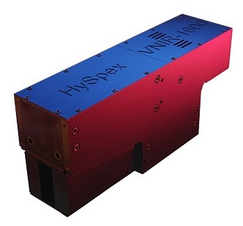
The Norsk Elektro Optikk (NEO) HySpex cameras feature a pair of hyperspectral scanners suitable for both airborne and ground-based survey. Established in 1985 to research the field of electro optics, the company has now grown to be the largest independent research and development organisation in electro optics in Norway. In addition to airborne and ground sensors, NEO has been actively engaged in space-related projects such as the development of hyperspectral imaging.
Hyperspectral imaging, also termed imaging spectroscopy, combines the fields of digital imaging and spectroscopy. The HySpex camera for each pixel captures the light intensity (radiance) for more than four hundred continuous spectral bands. The continuous spectrum obtained can be used to characterise objects with precision and detail.
Traditional colour cameras capture only the primary visual three spectral channels red, green and blue. This ability to capture data well beyond the spectral range of the human eye, along with the addition of hundreds of spectral bands, vastly improves object classification. The material spectra can be used against known indices such as vegetation health or mineralogical indices for geological applications.
Applications for remote sensing airborne hyperspectral images include:
- Forestry - mapping/classification, health monitoring.
- Agriculture - farming, growth monitoring, yield prediction.
- Geology - mineral mapping, environmental impact studies.
- Environmental - monitoring, algal blooms, oil spills.
- Government - land use monitoring, urban planning/development, coastal survey.
Thermal Imaging
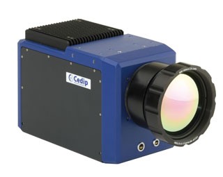
The Cedip Titanium thermal camera offers precision sensors with the highest sensitivity, accuracy, spatial resolution and minimum acquisition times, thus making it an ideal candidate for airborne survey operations. Cedip Infrared Systems, who have recently joined forces with the thermal manufacturing giant FLIR Systems, offers world-class technology and solutions in infrared imaging, optics, electronics and software.
State-of-the-art calibrated thermal cameras which support high frame rates and large sensor resolutions have now become available. This technology has primarily been developed through military research.
Applications for airborne thermal monitoring include:
- Thermal losses over urban and industrial areas
- Detection of heat islands within an urban environment
- Monitoring irrigation systems
- Detection of high leaf temperature indicating plant water stress
- Pipeline integrity and leak detection
- Oil spill monitoring and residues
- Ocean and water thermal currents and flows
